What is Ozone LiDAR - DIAL?
Ozone lidar is a remote sensing technique used to measure the concentration and distribution of ozone in the Earth’s atmosphere. It works by emitting pulses of laser light into the atmosphere and then analyzing the reflected light to determine the characteristics of the ozone layer.
How is Ozone measured by LiDAR?
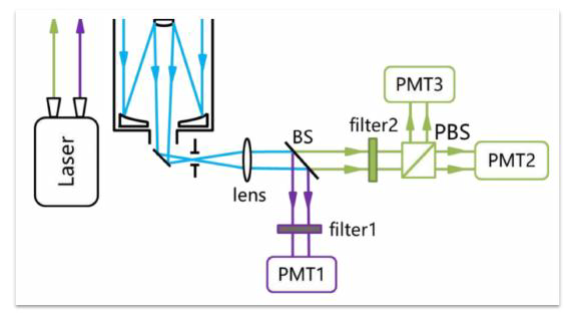
Figure below shows the principle diagram of the 3D ozone lidar system, which is mainly composed of three subsystems, including a laser emission system, an optical receiving system, and a signal processing and control system. The ozone lidar adopts the principle of differential absorption, emitting and receiving visible and ultraviolet lasers. By utilizing the absorption difference of ozone at different wavelengths, the telescope receives the optical echo signals generated by the interaction between laser pulses and ozone at different wavelengths. After signal detection, the echo signal profile for detecting atmosphere can be obtained. After being processed by the data inversion algorithm, relevant optical characteristic parameters in the atmosphere, such as extinction coefficient, backscattering coefficient, boundary layer height, etc., can be obtained. According to error sources, the measurement errors of ozone lidar mainly come from the influence of optical and mechanical structures, electronic interference, and uncertainty in data inversion methods.
ozone LiDAR Measurement - OD150 & RD150
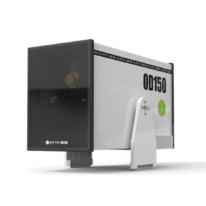
OD150
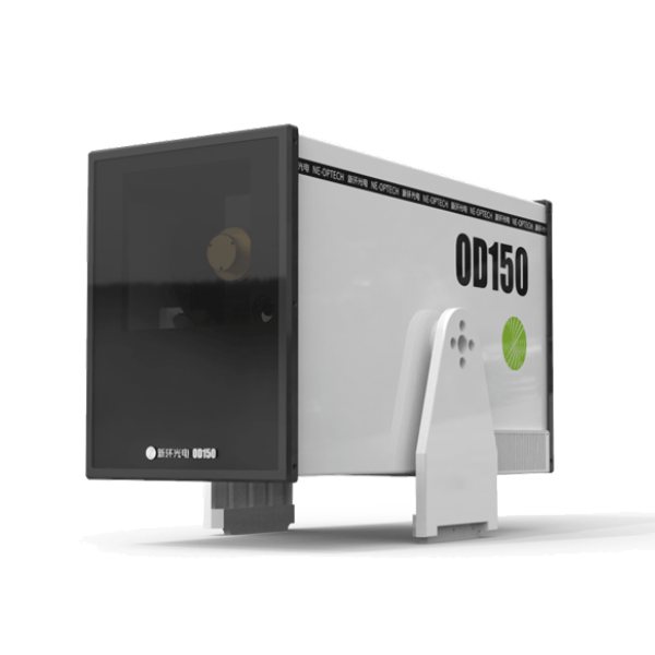
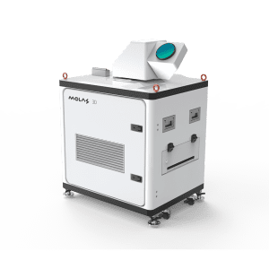
The 3D ozone lidar OD150 can achieve three-dimensional spatial detection of ozone. The system uses an all-solid-state laser as the light source, adopts the principle of differential absorption, and uses the absorption difference of ozone at different wavelengths to invert the ozone concentration distribution profile along the measurement path. The three-dimensional ozone detection lidar has vertical detection, scanning detection, and navigation detection functions, and is suitable for rapid ozone traceability, short-term forecasting, and emergency monitoring.
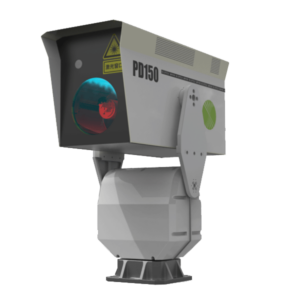
RD150
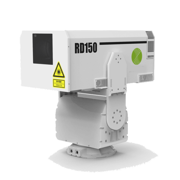
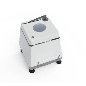
The three-dimensional Raman ozone lidar RD150 can realize three-dimensional spatial detection of ozone and particulate matter. The system uses an all-solid-state laser as the light source and has four detection wavelengths of 280nm, 295nm, 560nm, and 590nm. 280nm and 295nm can be inverted through the principle of ultraviolet differential absorption. Ozone concentration, 560nm and 590nm can invert the particle concentration. The three-dimensional Raman ozone lidar has vertical detection, scanning detection, and navigation detection functions, and is suitable for simultaneous and rapid source tracing of ozone and particulate matter, short-term forecasting, and emergency monitoring.
Specifications
Basic functions: | |
Detection distance (typical value) | 5km |
Range resolution | 3m or its integer multiple |
Unmeasurable distance | <20m |
Temporal resolution | 1s |
Laser wavelength | 266nm&532nm |
Pulse energy | 300uJ@532 nm |
Repetition frequency | 2kHz~7kHz, adjustable |
Power consumption | 200W |
Dimension | 580mm*254mm*335mm |
Weight | <30kg |
Operating temperature range | -20~+50℃ |
Specifications
Basic functions: | |
Detection distance (typical value) | ≥5km |
Range resolution | 3m or its integer multiple |
Unmeasurable distance | <20m |
Temporal resolution | 1s |
Laser wavelength | 280nm&295nm&560nm&590nm |
Pulse energy | ≥100μJ |
Repetition frequency | 2kHz~7kHz, adjustable |
Power consumption | 480W |
Dimension | ≤780mm×450mm×330mm |
Weight | <55kg |
Operating temperature range | -20~+50℃ |
Applications of Ozone LiDAR?
3D Scanning Detection
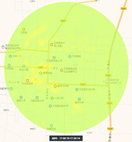
Analysis and judgment on local and external transmission of ozone pollution
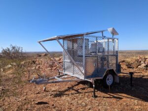
Mobile Observation
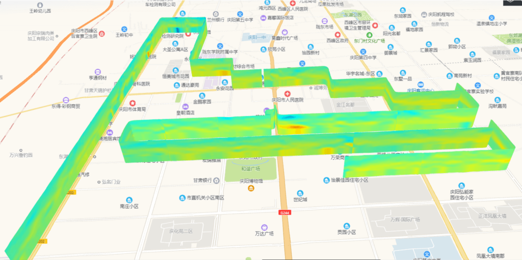
Normalize the site microenvironment to quickly trace the source of ozone pollution
THI (Time Height Indicator)

Emergency traceability of ozone pollution at sensitive points
q&a ozone LiDAR Measurement
Ozone (O3) is a molecule composed of three oxygen atoms. It occurs naturally in the Earth’s atmosphere and plays crucial roles at different levels of the atmosphere:
Stratospheric Ozone: Often referred to as the ozone layer, it exists in the stratosphere, a layer of the atmosphere that extends from about 10 to 50 kilometers above the Earth’s surface. This layer absorbs and scatters the solar ultraviolet radiation, significantly reducing the amount of UV radiation that reaches the surface. This is critical for protecting living organisms, including humans, from harmful UV rays, which can cause skin cancer, cataracts, and other health issues, as well as damage to plants and marine ecosystems.
Tropospheric Ozone: At ground level, ozone is considered a harmful air pollutant and a significant component of smog. It forms through reactions between oxides of nitrogen (NOx) and volatile organic compounds (VOC) in the presence of sunlight. High levels of ground-level ozone can have harmful effects on human health, including respiratory problems, aggravation of asthma, and reduction in lung function. It also affects plants and ecosystems by inhibiting photosynthesis, reducing crop yields and biodiversity, and damaging forests.
Environmental Impact of Ozone:
Protection from UV Radiation: In the stratosphere, ozone acts as a protective layer that shields the Earth from high levels of UV radiation, which are harmful to all forms of life.
Air Quality and Health: At ground level, ozone is a health hazard. It contributes to respiratory diseases and affects sensitive groups such as children, the elderly, and those with preexisting health conditions.
Climate Change: Ozone is a greenhouse gas and plays a complex role in the climate system. While it warms the troposphere, it also contributes to the cooling of the stratosphere. The overall impact of ozone on climate depends on its concentration in different parts of the atmosphere.
Vegetation and Ecosystems: Ozone can damage the foliage of trees and other plants, reducing growth and survival rates, which in turn affects ecosystems and the carbon cycle.
Managing ozone levels, particularly in the troposphere, is crucial for protecting health and the environment. This involves controlling the emissions of NOx and VOCs, which are the precursors to ozone formation.
Differential Absorption Lidar (DIAL) is a sophisticated remote sensing technique used to measure the concentration and distribution of various gases in the atmosphere, including pollutants like ozone. It operates by utilizing the principle that different gases absorb light at specific wavelengths.
Here’s how DIAL typically works:
Dual Wavelengths: DIAL systems emit laser pulses at two closely spaced wavelengths. One wavelength is strongly absorbed by the target gas (on-line wavelength), while the other is minimally absorbed (off-line wavelength).
Emission and Detection: The lidar emits these laser pulses into the atmosphere. After interacting with atmospheric constituents, the light is scattered back to the lidar system where it is collected by a telescope.
Analysis: By comparing the returned signals from the on-line and off-line wavelengths, scientists can calculate the concentration of the target gas. The difference in absorption between these two wavelengths is used to deduce the amount of the gas present along the path of the laser beam.
Vertical and Horizontal Profiling: By adjusting the timing of the laser pulses and their detection, DIAL can measure concentrations at different heights and distances. This capability allows for the creation of two-dimensional and three-dimensional maps of atmospheric gases.
DIAL is particularly valuable in environmental monitoring. It provides precise measurements of atmospheric pollutants like ozone, sulfur dioxide, nitrogen oxides, and others. Its ability to operate over long distances and its sensitivity to specific gases make it a crucial tool in atmospheric sciences, helping to monitor air quality and study atmospheric processes.
Lidar is a powerful tool for monitoring ozone because it provides high-resolution, three-dimensional data on ozone distribution in the atmosphere. This capability is crucial for understanding both the natural dynamics of ozone and its behavior in response to human activities. Here’s how lidar helps in ozone monitoring:
Vertical and Horizontal Profiling: Lidar can measure ozone concentrations at various altitudes and distances from the emission source. This is essential for studying the vertical structure of ozone in the atmosphere, particularly for assessing how much ozone is present in the troposphere versus the stratosphere.
Real-Time Monitoring: Lidar systems can provide near real-time data on ozone levels. This timeliness is vital for tracking the formation and movement of ozone, especially during pollution events or sudden atmospheric changes.
Wide Area Coverage: Lidar can cover large geographic areas, allowing for extensive monitoring that can encompass urban, suburban, and rural environments. This extensive coverage helps in tracking long-range transport of ozone and its precursors.
Differential Absorption Lidar (DIAL): As mentioned earlier, DIAL is a specific type of lidar that is highly effective for ozone monitoring. It measures ozone concentrations by utilizing two laser wavelengths—one that ozone absorbs and one it does not. By comparing the backscattered signals of these wavelengths, scientists can calculate the spatial distribution of ozone concentration across large volumes of the atmosphere.
Accuracy and Precision: Lidar provides accurate and precise measurements of ozone concentrations, which are crucial for compliance with environmental standards and for validating other monitoring techniques and models.
Research and Forecasting: The data collected by lidar are invaluable for atmospheric research, improving the understanding of ozone production and loss processes, and enhancing weather and air quality forecasting models.
Overall, lidar technology enhances the ability to monitor ozone dynamics continuously and accurately over large scales and at multiple altitudes, providing essential data for managing air quality and studying atmospheric phenomena.


