Molas 3D Wind Scanning & Atmospheric Lidar
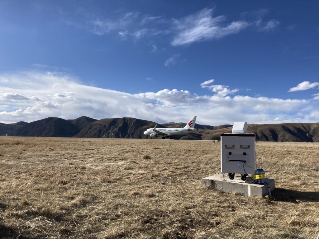
Wind lidar with 3D scanning is a strong tool for measuring wind patterns, and its accuracy and dependability make it a crucial component of many industries, including aviation. Wind shear and aircraft vortex identification are vital for guaranteeing safe takeoff and landing operations at airports, and 3D scanning wind lidar can help with this.
Wind shear is a short-distance change in wind speed and/or direction that can have major repercussions for aircraft during takeoff and landing. Wind shear may be detected in real-time using 3D scanning wind lidar, providing pilots with critical information that can help them make informed decisions regarding their flight operations.
Another critical factor in aviation safety is the aircraft vortex. When an aircraft generates lift, it also generates air vortices behind it, which can impact other aircraft flying nearby. These vortices may be detected and tracked using 3D scanning wind lidar, allowing air traffic controllers to modify flight routes and ensure safe separation distances between aircraft.
Remote sensing lidar is very effective for detecting wind shear and aircraft vortices because it can provide detailed data on wind patterns across broad areas. Remote sensing lidar can offer real-time data on wind shear and vortexes by monitoring wind patterns from an aeroplane or satellite, allowing pilots and air traffic controllers to make informed decisions about flight operations.
Airborne lidar systems are another critical component of airport wind shear and aircraft vortex detection. Airborne lidar systems can develop precise maps of wind patterns and other atmospheric characteristics by scanning the surroundings using laser beams. These maps may then be used to optimise flight trajectories and ensure safe takeoff and landing procedures.
Finally, 3D scanning wind lidar is crucial for airport wind shear and aircraft vortex identification. Its accuracy and dependability make it an indispensable instrument for maintaining safe flight operations, and it is increasingly being utilised in tandem with other technologies such as remote sensing lidar and airborne lidar systems. As technology advances, we may anticipate increasingly more advanced and inventive solutions for aviation safety.
3D scanning wind lidar is also a remote sensing system that measures wind speed and direction using laser-based wind detection. This technology is especially valuable in atmospheric monitoring, where accurate and dependable wind measurement is critical for understanding weather patterns and forecasting wind energy potential. To offer a thorough picture of the atmosphere, atmospheric lidar devices are frequently employed in conjunction with wind measuring equipment. Atmospheric lidar can give significant data on atmospheric conditions and the movement of air masses by measuring a variety of factors such as temperature, humidity, and pressure.
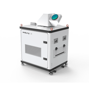
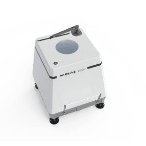
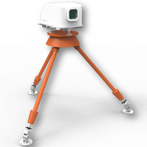
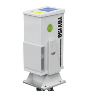
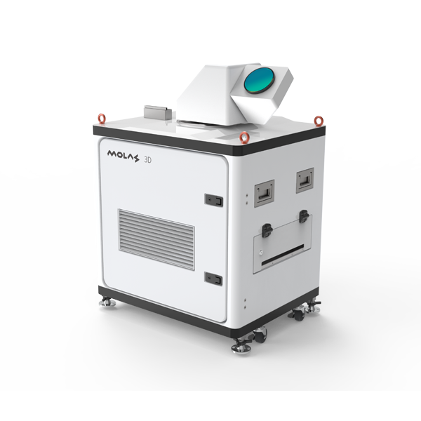
Molas 3D Scanning Wind LiDAR System
Specifications
Distance Measurement Parameters
Measurement Distance: 10km (Typical Situation)
Distance Resolution: 30m/45m/60m/75m Optional
Accumulation Time: 0.5s/1s/2s/4s/8s Optional
Wind Speed Measurement Accuary: 0.1m/s
Pointing Accuracy: 0.1°
Wind speed measurement range: -75m/s to 75m
Vertical Scan Range: -10°~190°
Compliance
Eye safety: IEC / EN 60825-1 ANIS Z136-1
Anti-corrosion level: C4
Anti-corrosion grade: ISO C5
Data Output
Communication method:
customizable
Others
Power Supply: 110VAC ± 20%
or 220VAC ±20%
Dimensions: 800X650X1130mm
Weight: <150kg
Working Environment
Working Temperature Range: -20℃ ~ 50℃
Survive Temperature Range:
-40℃ ~ 65℃(Power off)
-45℃ ~ 65℃(Power on)
Working Humidity Range: 0~100%RH
Protection Level: IP65
Contact Us - NZ
Molas 3D Scanning Wind Lidar Applications

Wind Resource Area
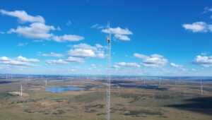
- Wind resource assessment: Molas 3D can measure a wide range of regional wind farm information and optimize wind farm site selection;
- Power curve test, wake eddy current measurement, optimize wind energy utilization and enhance the performance of WTGs

Civil Aviation Industry
- Detect and early alert dangerous metorological phenomena, such as wind shear, micro downburst etc.
- Measure wake vortex to optimize Flight Separation of airport traffic control.

Meteorological Measurement
- The information of wind field is provided to understand the state of wind in boundary layer
- It can provide accuracy and high precision wind profile information within a few kilometers near the surface to fill the gap of low altitude monitoring.

Air Quaility Testing Field
- Real-time 3D information of smoke and rain diffusion to track the emission sources
- Optimization of dust emission control in mining industry
The scanning system of Molas 3D scanning coherent Doppler lidar has strong programmability. The measurement plan and Lidar scanning mode configuration can be developed as per scope of the measurement and site conditions.
Molas 3D Wind Lidar Scanning Modes
The scanning system of Molas 3D scanning coherent Doppler lidar has strong programmability. The measurement plan and Lidar scanning mode configuration can be developed as per scope of the measurement and site conditions.
1. DBS ( Doppler Beam Swinging) wind profile scanning
Wind profile is the change curve of horizontal wind speed in the atmosphere with altitude. Molas 3D can continuously collect the Wind profile information directly above equipment, by measuring Radial wind speed of the five directions of east, south, west, north and vertical in turn, to calculate wind speed and wind direction profile data.


2. PPI ( Plan Position Indicator) scanning - Molas 3D scanning wind lidar
Molas 3D scans the radial wind speed over a large area with a fixed pitch angle and varying azimuth angle. This scanning method can clearly see the change of radial velocity information on the scanning surface, which is suitable for retrieving horizontal wind field at relatively flat terrain, or fine measurement the amount of wake, wind shear, etc.
3. RHI ( Range Height Indicator) scanning - Molas 3D wind scanning lidar
Molas 3D scans at a fixed azimuth and changes the pitch angle, scanning one or more vertical plane slices from top to bottom or bottom to top. This scanning method is suitable for observing changes in wind speed on the vertical plane.


4. Spot Scanning
Molas 3D can collect radial wind speeds in these directions in sequence according to the configured multiple azimuth and pitch angles. This method is generally used in conjunction with some customized inversion algorithms, or in order to improve the time resolution of PPI / RHI and speed up the acquisition speed of a single PPI / RHI. The collected data generally needs to be processed after post-processing.
5. Virtual wind tower scanning
Molas 3D lidar uses PPI scanning to scan a range at the target location (generally requires an azimuth greater than 60 degrees), which can reverse the wind speed and direction at that location. This method is suitable for measuring some places where it is inconvenient to place the radar under the measuring point, or some points with a lower height that cannot be directly measured by the wind profile.

Project examples of MOLAS 3D Scanning wind Lidar
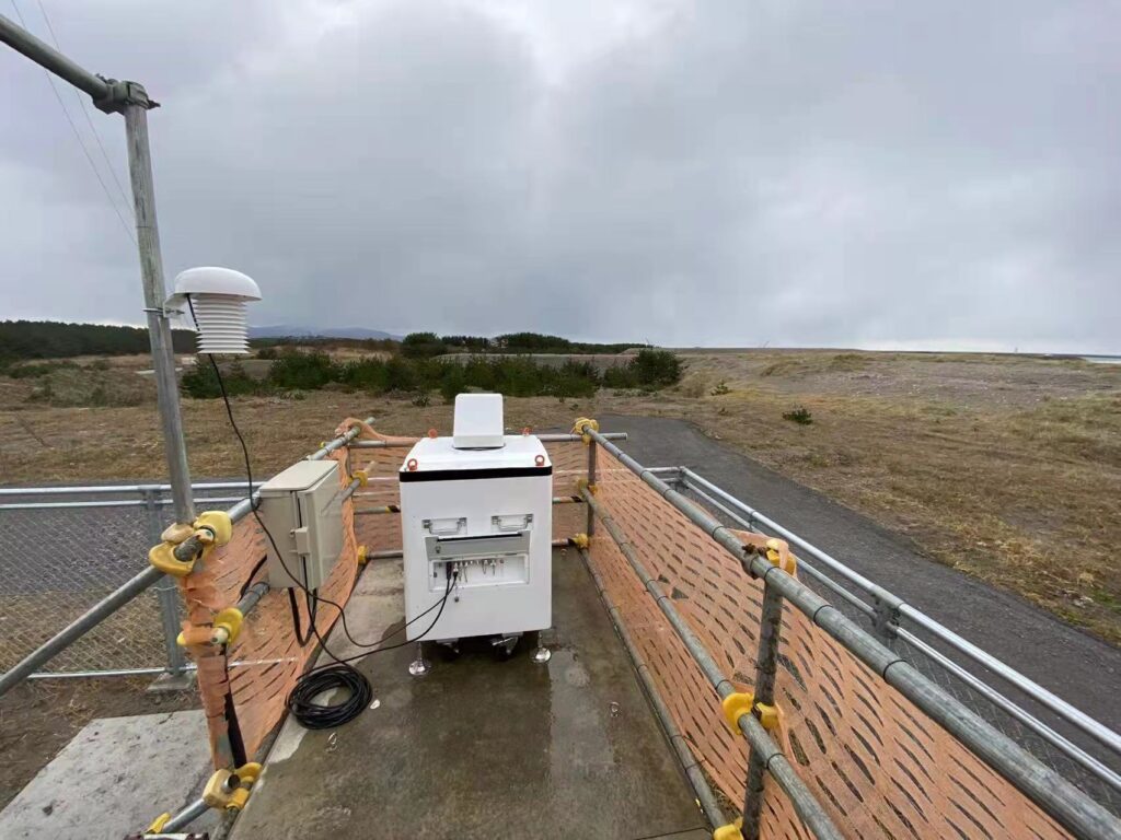
Civil Aviation Projects
Product: Molas 3D scanning Lidar;
Customer: Air traffic control department ;
Project Scope: Aircraft tail vortex and wind shear detection
Location: Xinjiang Kaishi Airport;
Project initiated: year 2018
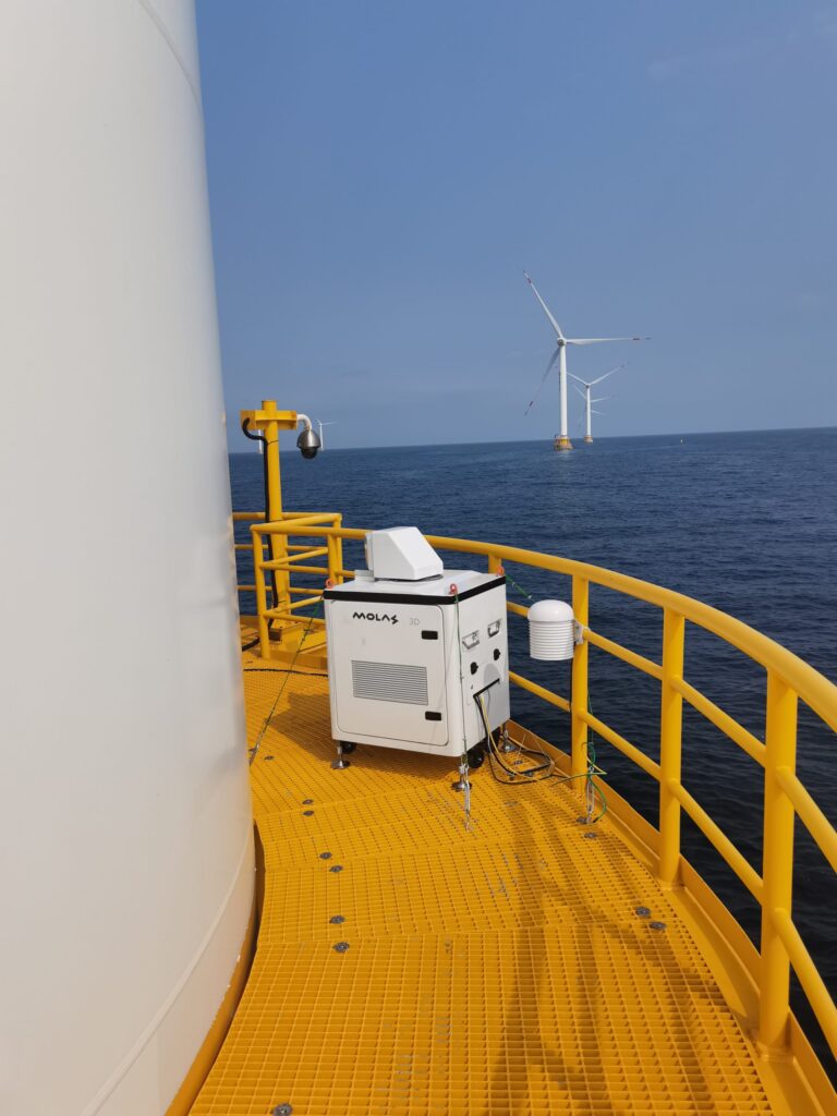
Offshore Wind Farm Project
-
Product: Molas 3D scanning Lidar;
-
Project Scope: Wind farm wake measurement;
-
Location: East Coast Offshore Wind Fram
-
Project initiated: year 2019
Civil Aviation Projects
Product: Molas 3D scanning Lidar;
Project Scope: Wind shear and Aircraft Vortex detection;
Location: Airports in Northwestern
Project initiated: year 2019
