LiDAR360 Point Cloud Data Management, Processing & Analyzing Software – 1 Year Subscription
US$3,600.00 Excl. GST/VAT
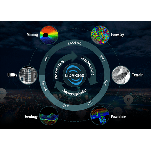
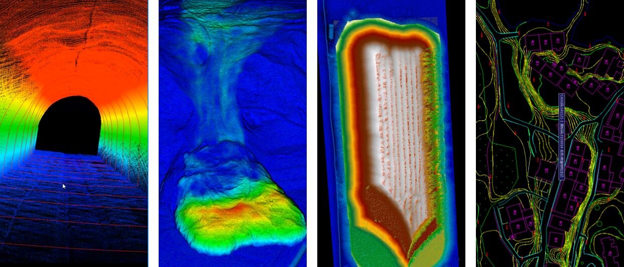
LiDAR360 is a GreenValley International’s Flagship LiDAR point cloud data processing and analysis platform, with more than 10 advanced point cloud data processing algorithms, which can process more than 300G point cloud data at the same time. The platform includes a comprehensive array of editing tools and automatic splicing functions, providing applications for the terrain, forestry, mining and power utilities industries.
The Terrain module is a suite of GIS tools used primarily for the generation of industry-standard topographic products. Our point cloud filtering algorithm can precisely extract ground points under complex landscapes and therefore improve the terrain surveying accuracy. The module also generates more advanced topographic products, such as TDOM, through the fusion of LiDAR and photogrammetry.
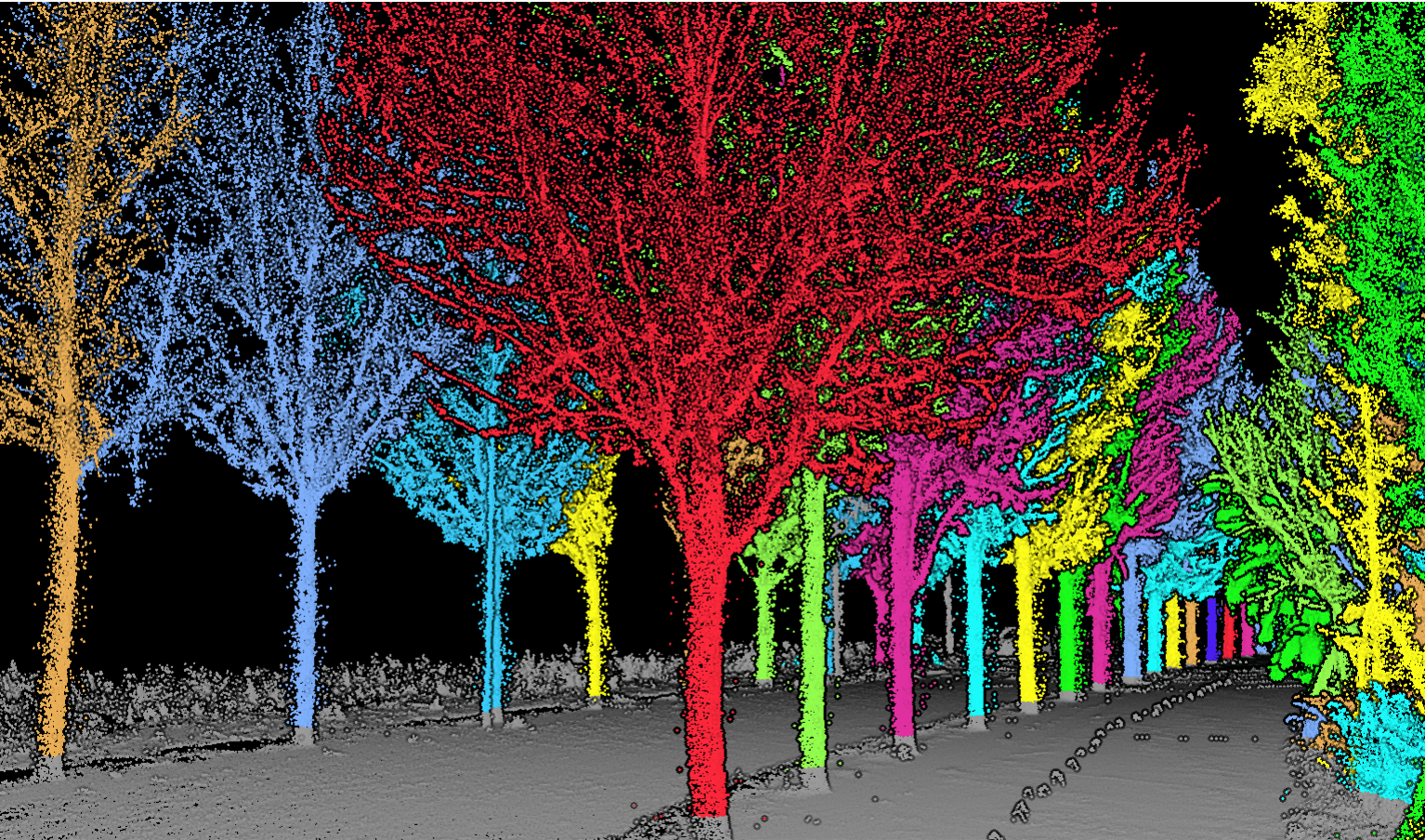
The Forestry module brings important technological innovations to forest inventory and analysis. It provides a unique toolset for manipulating point cloud collected from aerial and terrestrial LiDAR scanners. Defining individual tree level parameters, such as tree height, DBH, LAI, and crown diameter, are made possible through our segmentation algorithms. A range of regression models for predicting forest structures from LiDAR variables are also provided.
Delivery Terms:
DAP, Global shipping
Parts included in the package:
LiDAR360 Post-processing Software (1 year License);
Free Upgrade:
Free upgrade 1 year;
Lead Time:
3 days after order.
Table of Contents
LiDAR 360 Point Cloud and Analyzing Software- Introduction
LiDAR360 is a GreenValley International’s Flagship LiDAR point cloud data processing and analysis platform, with more than 10 advanced point cloud data processing algorithms, which can process more than 300G point cloud data at the same time. The platform includes a comprehensive array of editing tools and automatic splicing functions, providing applications for the terrain, forestry, mining and power utilities industries.
Data Source & Format Supported
- Data captured by: UAV, airborne LiDAR scanners, Terrestrial SLAM LiDAR Scanning equipment and photogrammetric
- Data format supported: las, ply, pcd, kml, csv, lidata, limodel, etc.
System Requirements:
- RAM: at least 8G or more.
- CPU: Intel® CoreTM i5/i7; Dual-core processor.
- Display Adapter: NVIDIA graphics card recommended, video memory no less than 2GB.
- Operating Systems: Microsoft Windows 7 (64-bit), Microsoft Windows 8 (64-bit), Microsoft Windows 10(64- bit),Microsoft Windows
11(64- bit) Microsoft Windows Server 2012 and higher.
Basic Modules of LiDAR360 Point Cloud Software
Strip Alignment
Point clouds from overlapped strips can be automatically aligned based on strict geometric model. The software can display aligned strips in real-time and generate aligned point clouds with high accuracy. The module also provides a series of tools to check and analyze data quality.
Data Management
The module provides management tools for point cloud and raster data, which include format conversion, point cloud de-noising, normalization, raster band calculation and so on.
Statistics
Based on the number, density and elevation of LiDAR points, statistics can be calculated for data quality evaluation.
Classify
The module provides various classification methods for point cloud classification including ground classification, ground key point classification, interactive classification, machine-learning-based classification (for building, vegetation, and custom classes) etc.
Industry Specific Modules of LiDAR360 Point Cloud Software
Terrain
The module can generate DEM(Digital Elevation Model), DSM(Digital Surface Model), CHM(Canopy Height Model) for geospatial applications. Other related topographic products such as Hillshade, Slope, Aspect, Roughness and Contour are also supported.
Mine
Based on LiDAR point cloud data and model data (.LiTin, .obj), 3D model construction, closed model volume measurement, volume change analysis, and open-pit mine slope line extraction can be carried out.
Vector Editor
The module provides vectorization functions for DLG (Digital Line Graphics) workflow. The software displays point cloud as a high-contrast base map, in which contours of objects (e.g., building, vegetation, roads, street lamps, water, bridges) can be clearly identified and vectorized.
Geology
Extract terrain features, geological structure surface features, etc. based on airborne lidar point cloud data.
ALS Forest
Based on ALS(Airborne Laser Scanning) data, the module can extract a series of forestry parameters(Elevation Metrics, Leaf Area Index, Canopy Cover, etc.), segment individual trees and calculate parameters of individual tree(position, height, canopy, etc.). Moreover, various regression functions are also provided which can be used in combination with field measurement to retrieve forest parameters that cannot be directly derived from ALS LiDAR data (such as biomass or stem volume).
TLS Forest
Based on TLS(Terrestrial Laser Scanning) data, the module can estimate the number of trees, extract DBH(Diameter at Breast Height) with batch processing, segment individual tree, and calculate parameters of individual tree(position, height, etc.).
Powerline
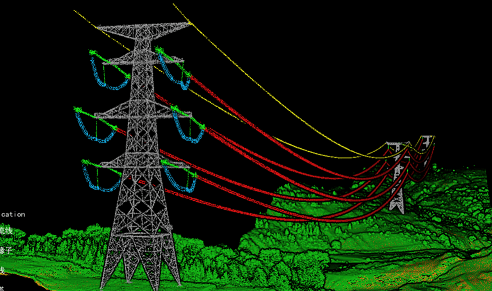
Obtaining a clearance distance analysis report based on airborne LiDAR point cloud data, including towers positioning, data classification, and danger point detection.
LiDAR360 Downloads & Tutorials
LiDAR360 Video Tutorials
Related products
- LiDAR Point Cloud Processing Software
LiDAR360 MLS HD LiDAR Mapping Software – 1 Year Subscription
US$3,600.00 Excl. GST/VAT Add to cartRated 0 out of 5 - LiDAR Point Cloud Processing Software
LiPowerline – Powerline Point Cloud Data Analyzing Software – 1 Year Subscription
US$3,600.00 Excl. GST/VAT Add to cartRated 0 out of 5 - LiDAR Point Cloud Processing Software
PCMaster Pro
US$2,500.00 – US$3,500.00 Excl. GST/VAT View productsRated 0 out of 5 - LiDAR Point Cloud Processing Software
Trion Model Software By FJD
US$816.00 – US$1,271.00 Excl. GST/VAT View productsRated 0 out of 5
