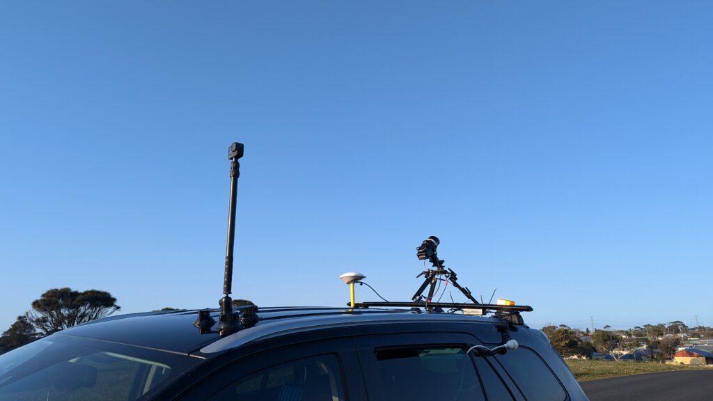
We’re thrilled to announce the successful completion of a comprehensive wind turbine transport route assessment by using cutting-edge vehicle-mounted LiDAR technology for our valued customer, Westwind Energy! This critical project covered the route from Portland Port to Warracknabeal, including the proposed wind farm’s internal roads.
Our liDAR Solutions for transport route assessment
To ensure precision and efficiency, we leveraged cutting-edge technologies, including:
LiDAR technology offers a host of advantages over traditional surveying methods:
Speed: Simply drive along the route after initializing the LiDAR system.
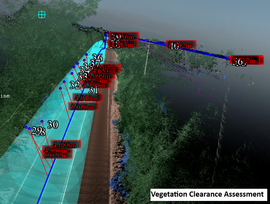
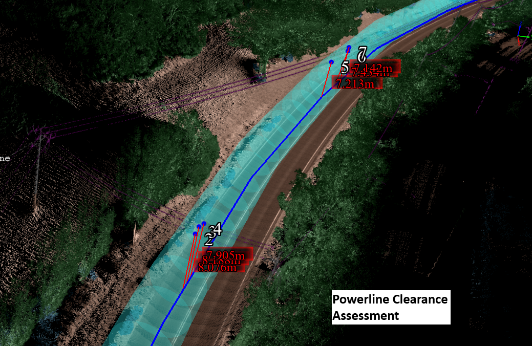
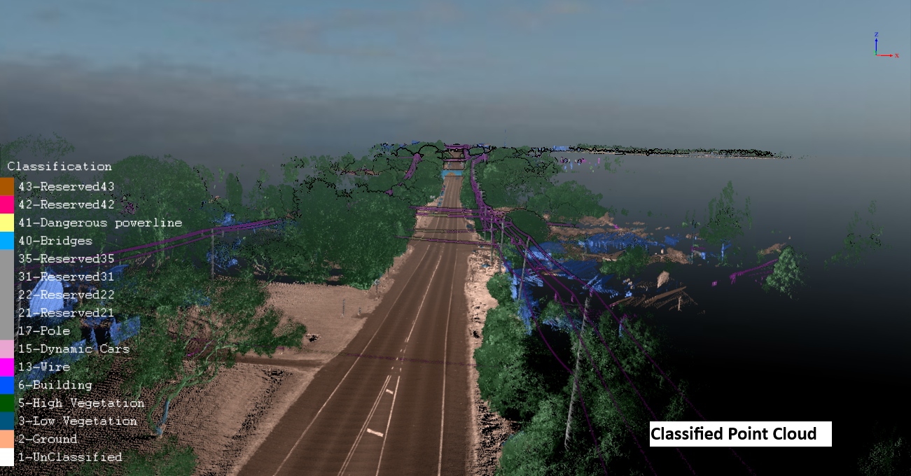
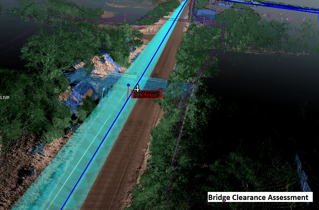
Rich Data: Mobile-mounted LiDAR captures all obstacles within direct sight, ensuring no details are missed.
Accuracy: Achieves centimeter-level precision, critical for clearance assessments.
What We Offer at LiDAR Solutions Australia
Our goal is to empower businesses with tailored solutions, whether it’s:
Turnkey Solutions: For small-scale projects, we handle everything—from site scanning and data processing to report generation and project management.
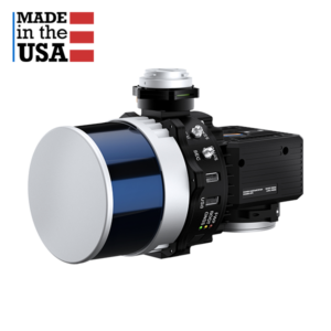
Products, Training & Support: For pipeline projects or service providers, we supply industry-leading LiDAR hardware (Inertial Labs) and processing software (Greenvalley) while offering comprehensive training to ensure success.
Our expertise and partnerships ensure that our customers have access to world-class solutions and knowledge & experience transfer tailored to their needs.
Interested in how LiDAR technology can transform your next project? Contact us at info@lidarsolutions.com.au to learn more!
Contact Us Today!
Learn more about how our LiDAR Solutions can make your transport route assessment sucessful.

 LiDAR Point Cloud Processing Software
