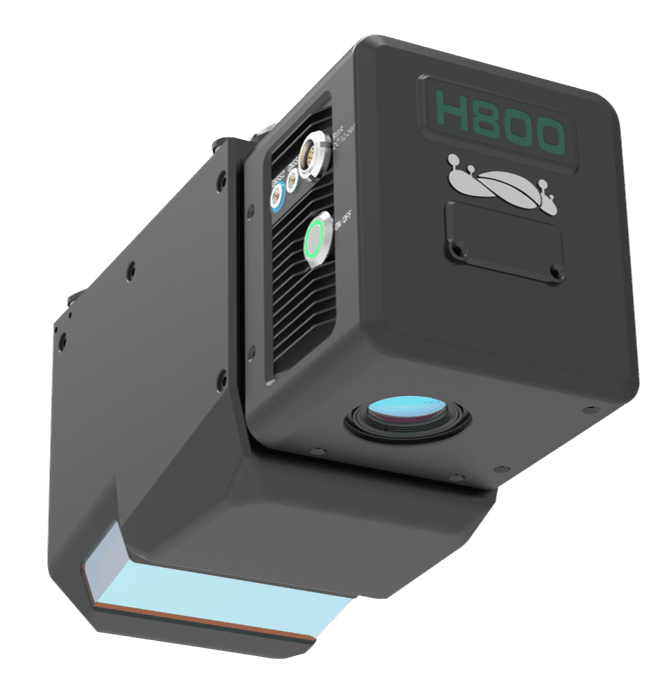
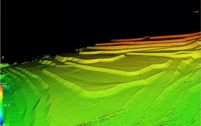
Find Us In Booth W60

LiAir H800 Drone LiDAR Scanner – Long Range

US$65,000.00 Excl. GST/VAT

LiAir H800 is a new generation of medium and long range lidar scanning system developed. It integrates domestic light and small lidar, self-developed inertial navigation and built-in high-resolution mapping camera. It has the advantages of lightweight and long range. It can be used with flight control software GreenValley and data post-processing software LiGeoReference , and the product is compatible with M350\M300 RTK .

Key Features of LiAir H800 Long Range Drone LiDAR Scanner

LiAir H800 has light weight design, and can be carried by DJI M300 or M350. With longer scanning range, better penetration ability, it performs better than mini-LiDAR systems in forestry, emergency disaster surveys, and long-range powerline inspections, etc.

Long Range

Up to 1000m scanning range

High Frequency

Up to 1000 kHz scanning frequency

High Accuracy

5mm point cloud thickness

High Penetration

Smaller light spots - 5cm circle @ 100m; 7 returns

Light Weight

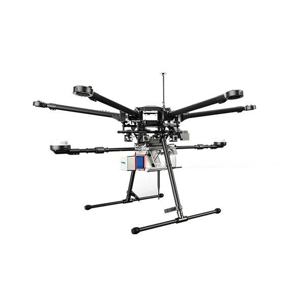
Only 2.2kg, compatible with DJI M300 & M350

Intelligent

Self-adpative point cloud density

Specification of LiAir H800

specs of liair h800 long range drone lidar

Why customers choose LiAir H800

Compatibility with common drones - M300/350 compatible

LIAIR H800 LONG RANGE DRONE LIDAR PAYLOAD

Light weight & long range

2.2kg Weigh,can be carried by DJI M350 / M300 RTK

High accuracy - less than 5mm point cloud thickness on hard surface

Wide FOV & high coverage

High penetration - Small light spot and 7 returns

Small Light Spot
Support 7 Echoes Algorithm

The laser spot is small and the energy is more concentrated, and it also support 7 renturs, these enable H800 to have stronger penetration ability for dense forest areas.

  • H800 light spot 5cm diameter @ 100m;
  • Known Brand L2 4 × 12 cm @ 100m
Point Cloud displayed by returns
Point cloud displayed by classification, which shows adequate ground points are captured by H800

More dense and smooth point clouds than competition models

Point Cloud Captured by H800 @ 400m
Point cloud captured by competition model @ 400m


  • H800 capture more details at 400m
  • H800 has better penetration to the ground
Point Cloud Captured by H800 @ 400m More smooth
Point cloud captured by competition model @ 400m

Required Software for LiAir H800 Drone Long Range LiDAR Scanner

Pre-processing Software

Date management, Post-processing and Analyzing Software

Request for Quote & Information

    1. LiDAR Point Cloud Processing SoftwareUAV LiDAR PayloadHandheld LiDAR ScannersBackpack LiDARsVehicle-mounted LiDARsGNSS ReceiversOther Products
    2. PriceTechnical ProposalSolutionsOthers
    3. YesNo

    * Required

    en_USEnglish
    ×