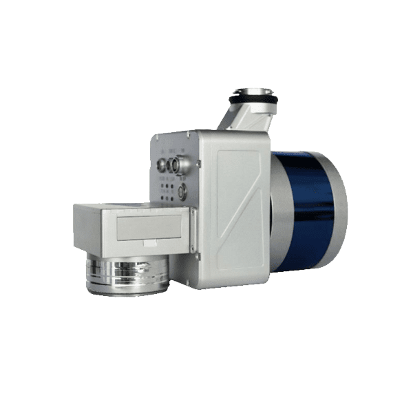
LiAir X3C-H Drone LiDAR Scanner – 32 Channel LiDAR Sensors
Request For Quote
The LiAir X3C-H is a new compact high-performance UAV LiDAR system and is the upgraded version of the LiAir 50N by GreenValley International. It adopts a new integrated design style and built-in high-resolution mapping camera, providing higher performance and convenient operation for power-line inspection, topographic surveying, agricultural and forest monitoring, and more.
General Specification of LiAir X3C-H LiDAR for Drone
Range Accuracy: ±3 cm
Detection Range:
80m (reflectance ≥ 10%) 200m (reflectance ≥ 54%) 300m (reflectance ≥ 90%)
Channels: 32
Power Consumption: 24 W
System Accuracy: ± 5 cm
POS System Performance:
Attitude: 0.008° (1σ)
Azimuth: 0.038° (1σ)
Mounting Platform: DJI’s Matrice 600 Pro, M300 RTK
Camera (Optional): Sony A5100
Weight: 1.12 kg
Dimensions (Incl. Camera) 200* 105* 160 mm
Field of View: 360° (Horizontal) X 43° (Vertical)
Number of Returns: 3
Scan Rate: First Return: 640,000 points/s
Dual Return: 1,280,000 points/s
Triple Return: 1,920,000 points/s
Downloads for LiAir X3C-H LiDAR for Drone
Brochure
User Manual
Required Software for LiAir X3C-H Drone LiDAR Scanner
Pre-processing Software
Date management, Post-processing and Analyzing Software
Request for Quote
Related products
- GNSS Receiver
LiBase – GNSS RTK GPS Receiver for Both Rover & Base Station
US$2,916.00 Excl. GST/VAT Add to cartRated 0 out of 5 - drone lidar with premium INS
RESEPI-HESAI XT32M2X – From Inertial Labs, Manufactured In USA
Request For QuoteRated 0 out of 5 - drone lidar with premium INS
RESEPI-HESAI XT32 – From Inertial Labs, Manufactured In USA
Request For QuoteRated 0 out of 5 - drone lidar with premium INS
RESEPI-LIVOX AVIA – From Inertial Labs, Manufactured In USA
Request For QuoteRated 0 out of 5
